Following the West Highland Line

Fort William → Mallaig

A westward journey where road and rail share one of the most celebrated landscapes in the world

~43 miles

Approximately 69 km

~1hr 15mins

(Direct)

Half day to 1 day

One of the WC300’s most cinematic sections
Photography, rail heritage, beaches and big coastal views
Glenfinnan · Lochailort · Arisaig · Morar · Mallaig
Good — fuel available at Fort William and Mallaig
Good at Fort William and Mallaig; limited between Glenfinnan and Arisaig
Fort William · Glenfinnan · Arisaig · Mallaig

Following the West Highland Line

Overview: Fort Wiliam – Mallaig

The Road to the Isles

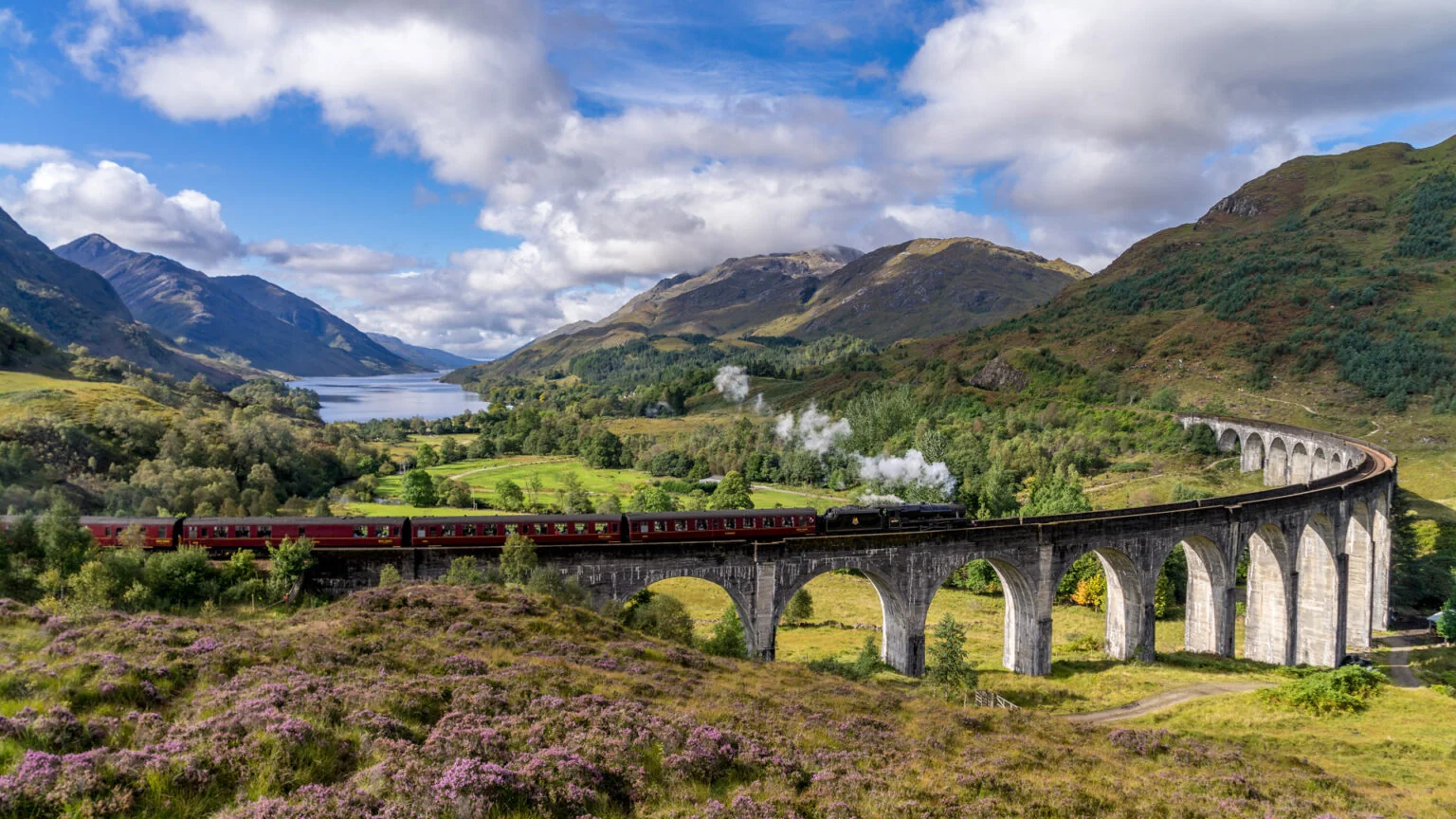
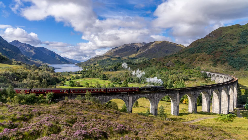
Leaving Fort William, the road follows Loch Eil west before climbing to Glenfinnan, where Loch Shiel opens dramatically between mountain walls and the famous viaduct curves overhead. Beyond it, the route grows wilder through Lochailort and open moorland.

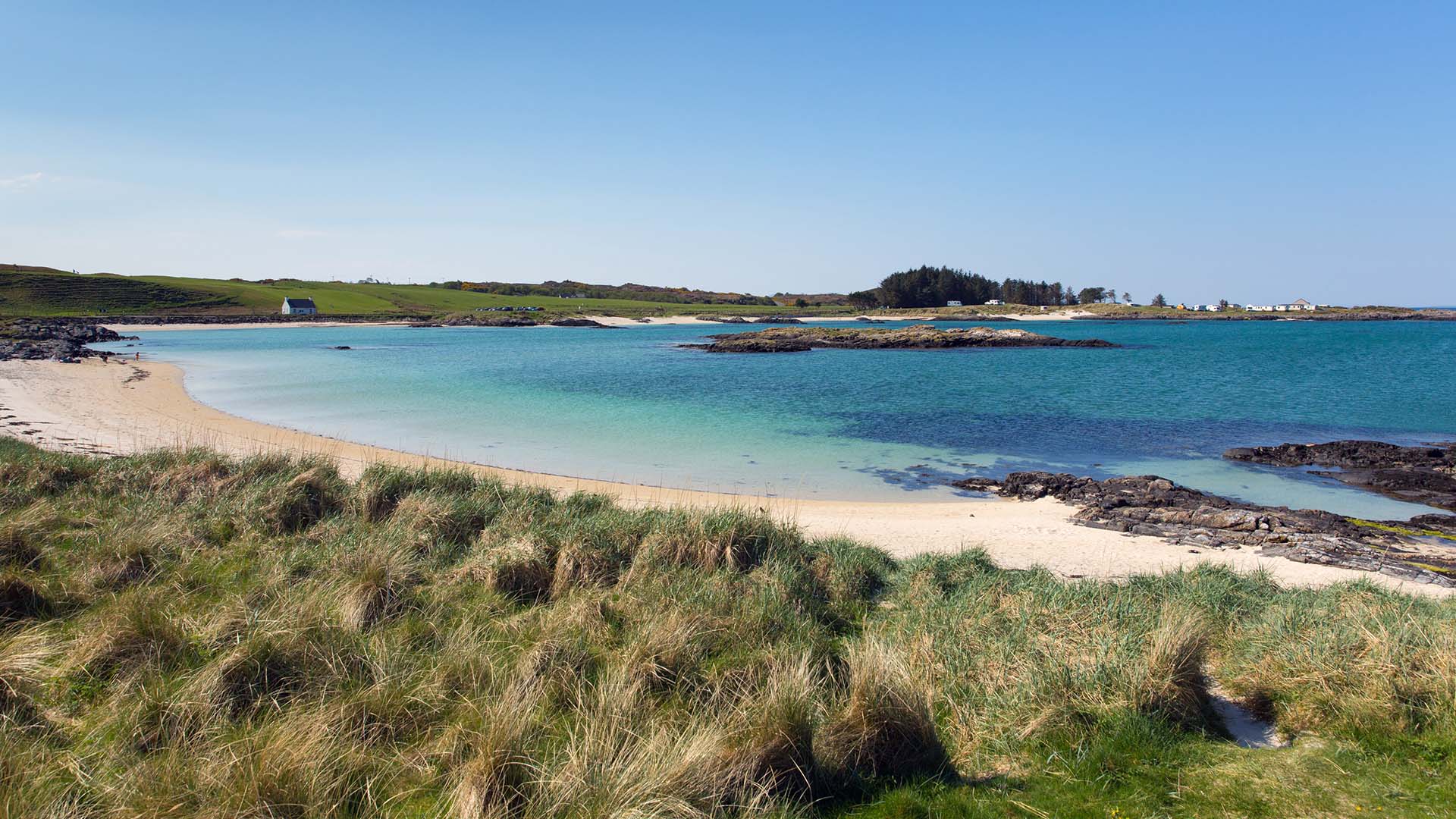
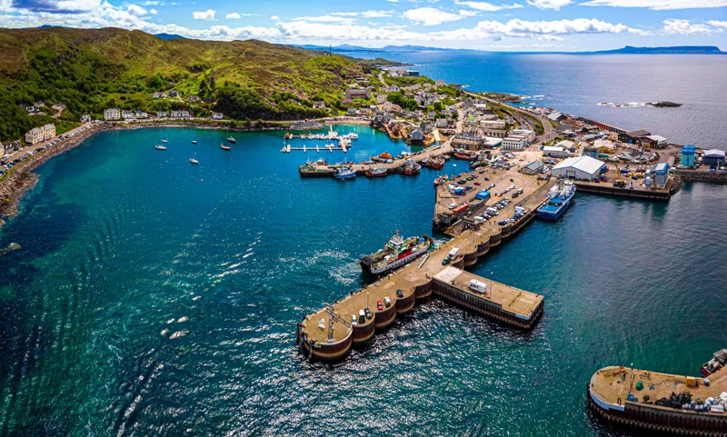
The coast arrives suddenly near Arisaig, with Eigg and Rum on the horizon, before the white sands of Morar lead into Mallaig — a working fishing harbour facing Skye across the Sound of Sleat.

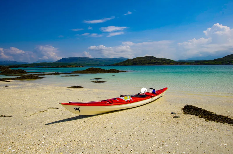
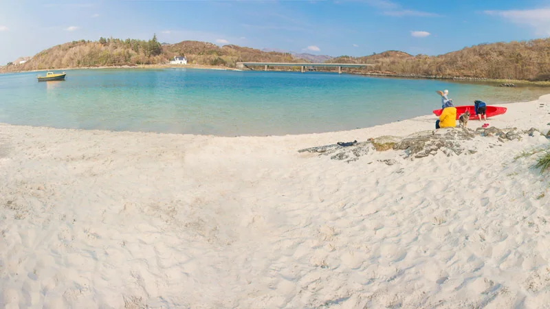
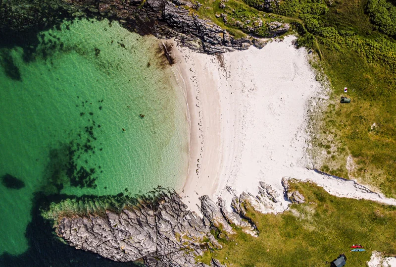
Arisaig – pale sand, clear water and islands on the horizon. After the enclosed glens, the coast opens the journey out. Take a moment to watch the light move across the bay.

Weather

WC300 Weather

Basic route weather

Forecast for key points along this route segment. This is the basic forecast; members unlock deeper route-aware weather intelligence.

Fort William → Mallaig
Mid-route Light rain 9°C
Rain
54%
Wind
6 mph W

Unlock full WC300 weather intelligence

Basic weather is available to everyone. Members get deeper route-aware forecasts, including the next few hours, 7-day outlook, start/mid/end route conditions and practical guidance for when to drive, stop, walk, photograph and explore.

Explore WC300 Membership Designed for real journeys on the WC300 Core Route and WC300+ Extensions.
Last updated: 2026-10-25 14:00:23 Powered by Met Office data

“Give yourself time at Glenfinnan, but save a few hours for the coast. You’ll want to get out, walk on the sand and forget about reaching Mallaig for a while.”

Things to see and do

Best Places to Pause

Pause Here

Arisaig Coastal Pull-ins

Several informal pull-ins along the A830 near Arisaig give direct views west to the islands. Clear days reveal the Skye Cuillin on the northern horizon.

Members

More places to pause

Unlock more scenic pauses, viewpoints and worthwhile stops along this stretch.

Members unlock 3 more places to pause on Fort William → Mallaig

Explore WC300 Membership

Route Highlights

Loch Eil

The A830 follows the northern shore of Loch Eil west from Fort William. The loch is narrow and tidal, with Ben Nevis visible on the return glance east. A quiet opening to the segment before the drama of Glenfinnan.

Glenfinnan and Loch Shiel

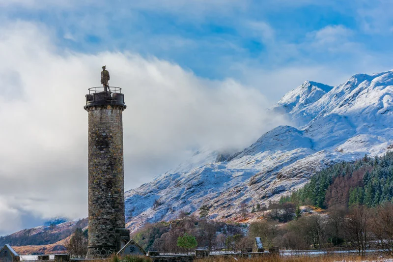
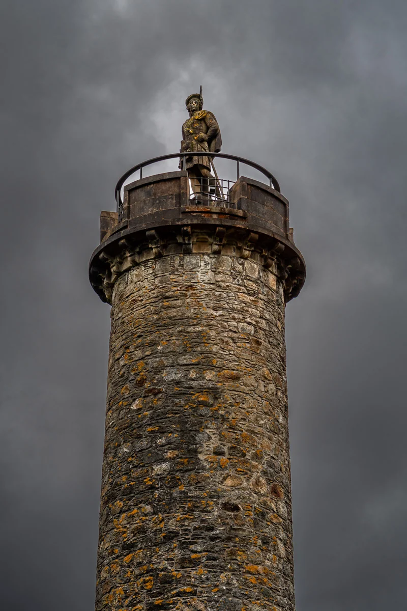
The head of Loch Shiel is one of the most dramatic viewpoints on the entire WC300. The loch runs south for eighteen miles between steep mountain walls, the Glenfinnan Monument stands at the water’s edge, and the West Highland Viaduct curves across the hillside above. The landscape here demands time.

Glenfinnan Viaduct

The 21-arch viaduct built in 1901 carries the West Highland Line – widely regarded as one of the world’s great scenic railway journeys – across the valley above Glenfinnan. The viaduct is recognised around the world from the Harry Potter films, where it appears on the route of the Hogwarts Express.

Lochailort and the Interior

Beyond Glenfinnan the road climbs into open moorland – lochs, bog and bare hillside stretching in all directions. Lochailort sits at a sea loch inlet and marks the point where the route begins its descent toward the Atlantic coast. The landscape here is among the most remote on the segment.

Arisaig Coast

The Atlantic coast appears near Arisaig – rocky shoreline, island views and the sudden sense of open ocean after miles of inland travel. The views west to Eigg, Rum and the Skye Cuillin on clear days are exceptional.

Silver Sands of Morar

The beaches between Morar and Mallaig are among the finest on the Scottish mainland – white sand, clear water and views to the Small Isles. The River Morar, one of Scotland’s shortest rivers, drains Loch Morar into the sea through the sands at Morar Bay.

Mallaig

The western terminus of the Road to the Isles and the WC300’s first encounter with the Hebridean ferry network. The harbour faces Skye across the Sound of Sleat and the town has the unpretentious character of a place that exists for practical reasons rather than tourism. Mallaig is also the departure point for the WC300+ Extension to the Isle of Skye by ferry.

Photography Highlights

Photography Highlights

Silver Sands of Morar

White sand and clear water with the Small Isles on the horizon. Backlit afternoon light from the west. The river mouth where the Morar meets the sea adds foreground interest.
Best time: Late afternoon
Best season: May–September

Photography Highlights

Arisaig Coast – Island Views

Telephoto work on Eigg and Rum from the coastal pull-ins west of Arisaig. Clear days reveal the Skye Cuillin to the north. The islands are best defined in morning light from the east.
Best time: Morning
Best season: April–October

Members

More photography highlights

Unlock more viewpoints, compositions and photography opportunities along this stretch.

Location, timing and composition guidance for better results.

Members unlock 3 more photography locations on Fort William → Mallaig

Explore WC300 Membership

Lesser Known Stops

Lesser Known Stops

Arisaig Harbour

The small harbour at Arisaig village sits in a sheltered bay with views south to Moidart. Quiet and unhurried – a genuine contrast to the open coastal road. The summer ferry service to the Small Isles departs from here – check timetable in advance.

Lesser Known Stops

Loch Eilt Viewpoint

Between Lochailort and Glenfinnan, Loch Eilt stretches along the roadside with a small wooded island in the centre. On calm days the reflection of the island and surrounding hills is exceptional. Frequently used as a film location and largely overlooked by passing travellers.

Members

More lesser-known stops

Unlock more quiet corners, overlooked places and local discoveries along this stretch.

Members unlock 1 more lesser-known stop on Fort William → Mallaig

Explore WC300 Membership

Allow Extra Time For

Allow Extra Time For

The Moorland Interior

The drive between Glenfinnan and Lochailort is one of the most remote-feeling sections of the entire WC300. Resist the urge to push through it quickly – the landscape rewards a slower pace.

Members

More places worth slowing down for

Unlock more worthwhile stops, short walks and places that deserve a little longer.

Members unlock 2 more places worth slowing down for on Fort William → Mallaig

Explore WC300 Membership

Wildlife & Nature

Wildlife Intelligence

  • Otter – sea lochs between Lochailort and Mallaig, one of the most reliable stretches on the whole WC300; look for movement among the kelp at low tide, dawn and dusk
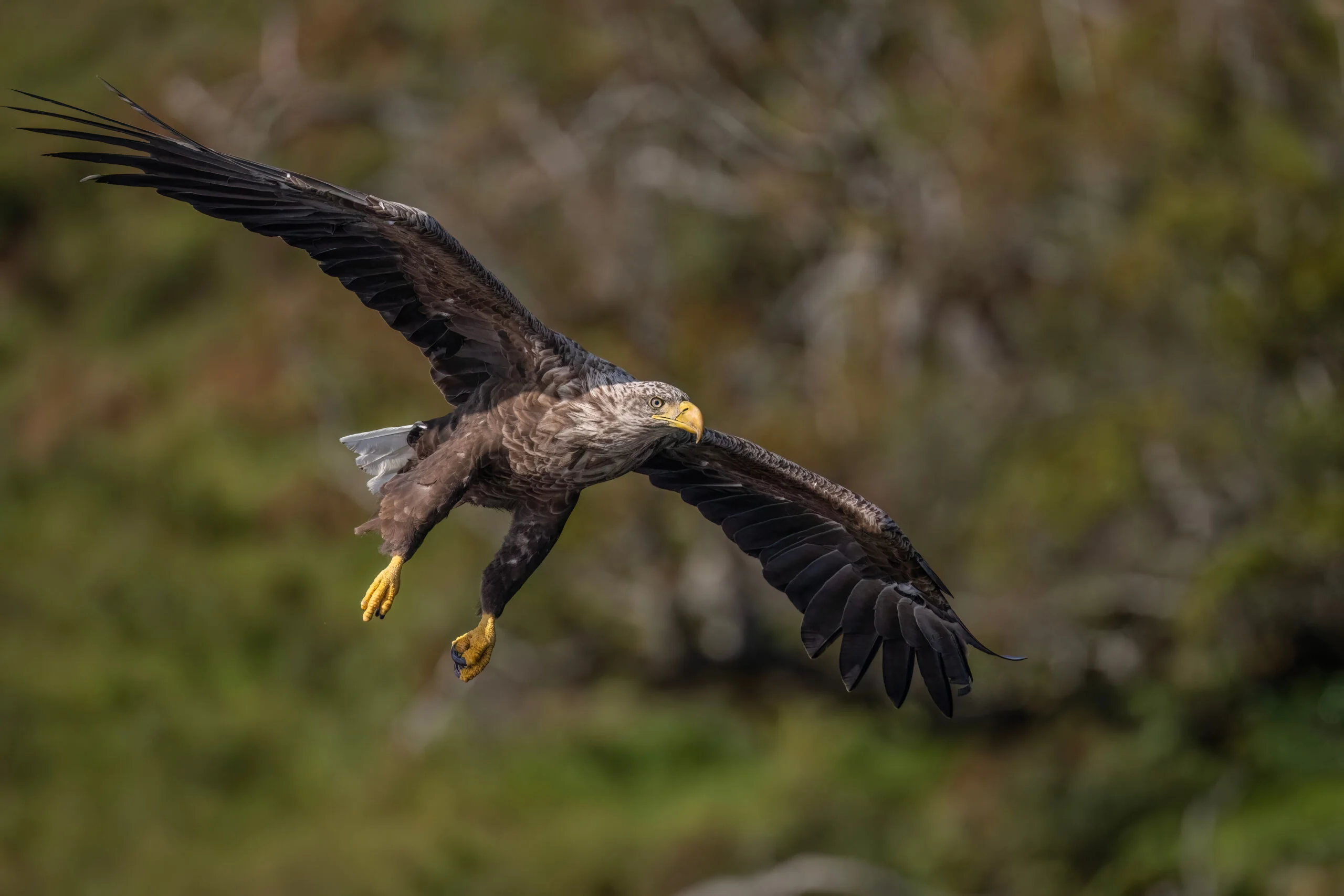
  • White-tailed eagle – scan wooded headlands above the Arisaig coast on early morning thermals; size against a common buzzard is the reliable identifier
  • Harbour porpoise – the most frequently seen cetacean on this segment; look for brief dorsal fin breaks in calm water from pull-ins near Arisaig
  • Grey seal – skerries along the Arisaig coast and the approaches to Mallaig; haul out at low tide; approach slowly from landward
  • Puffin – visible from the Arisaig coast on Eigg and Rum; binoculars needed for the island colonies; present May–July only
  • Minke whale – open water off Arisaig, July–September; look for a low, rolling surfacing with a small dorsal fin
  • Orca – rare but recorded in the Sound of Sleat and wider Hebridean waters; encounters remain uncommon but not unknown

Local Knowledge

Local Knowledge

  • Fill up with fuel at Fort William – there’s no reliable stop until Mallaig
  • Mobile signal effectively disappears between Glenfinnan and Arisaig; download maps before leaving Fort William
  • The Glenfinnan Viaduct hillside path takes fifteen minutes from the car park and gives a far better view than the visitor area below – most people miss it
  • Camusdarach Beach is quieter than the Silver Sands and arguably finer; the short walk keeps most visitors away
  • The Jacobite steam train crossing at Glenfinnan is worth planning around for photography; timetables are seasonal and publicly listed
  • Mallaig is a working town rather than a scenic resort – the harbour has real character, but don’t arrive expecting polish

Good to Know

  • Fuel – Fort William and Mallaig only; fill up before leaving Fort William
  • Toilets – Fort William, Glenfinnan, Arisaig, Mallaig
  • Mobile signal – good at Fort William and Mallaig; limited through Glenfinnan, Lochailort and the moorland interior
  • Glenfinnan Viaduct steam train – the Jacobite service runs seasonally; timetables are publicly listed and worth checking if this is a priority
  • Road type – A830 throughout, generally well surfaced; some coastal side roads and beach access roads may be single track
  • Mallaig ferry – the CalMac crossing to Skye departs from Mallaig, the starting point for the WC300+ Isle of Skye Extension; book well ahead for summer travel
  • Parking – managed car park at Glenfinnan; harbour parking at Mallaig

Secret Routes & Diversions

Secret Routes & Diversions

Rhu: walk beyond the road to Port na Murrach — member preview

Leave the A830 for Arisaig, then follow the minor Rhu road south-west to its end. Continue on foot towards Port na Murrach, where a stony track gradually gives way to a rougher path and a final descent to two sandy bays.

The full guide is available to WC300 members.

Members

Secret routes and diversions

Members unlock carefully selected hidden roads, quiet diversions and rewarding alternatives.

Carefully selected diversions researched for WC300 members.

Members unlock 2 more secret routes and diversions on Fort William → Mallaig

Explore WC300 Membership

History & Culture

History & Culture

Glenfinnan: who paid for remembrance? — a taste of the story

Stand beside Glenfinnan Monument and consider the people who financed the landscape of remembrance. Its commissioner, Alexander MacDonald of Glenaladale, inherited wealth from his father, Sandy, who returned from Jamaica and bought the estate in the 1770s.

The full story is available to WC300 members.

Members

More stories behind the journey

Unlock more history, cultural context and events that shaped this stretch of the route.

Members unlock 5 more stories behind the journey on Fort William → Mallaig

Explore WC300 Membership

History & Cultural

  • Glenfinnan Monument (1815) – marks the spot where Bonnie Prince Charlie raised the Jacobite standard in August 1745, beginning the last Jacobite rising
  • The ’45 rising – the road west from Glenfinnan follows the route taken by the Jacobite army toward its early victories; the landscape still carries the weight of that campaign
  • West Highland Railway – the Fort William to Mallaig line, completed in 1901, was one of the last great feats of Victorian railway engineering; the Glenfinnan Viaduct remains its most celebrated structure
  • Mallaig as a herring port – the town grew rapidly in the late 19th century as a herring fishing centre after the railway arrived; at its peak it was one of Europe’s busiest herring ports
  • Loch Morar – at 310 metres, the deepest freshwater loch in the British Isles; the River Morar connecting it to the sea is one of Scotland’s shortest rivers, and the loch has its own monster legend
WEST COAST 300

Explore WC300

Explore the mapFind your next west coast stop.
MAKE TIME FOR THE WEST COAST

    These are starting suggestions, not timed journey plans. Three days covers selected parts; five and seven days outline the complete WC300 Core Route. Allow for stops, road conditions and the Corran Ferry. WC300+ Extensions are optional and need additional time.

    Open your journey plannerMembership gives you a place to build and save your plan.

    Fort William → Mallaig